Attractions
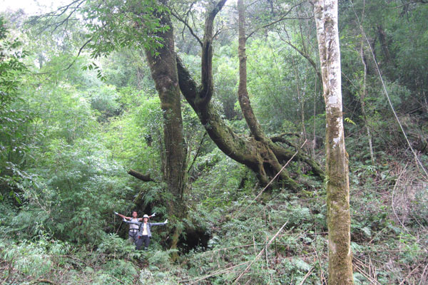
Hoang Lien National Park is located in territory of Sa Pa town of communes: San Sa Ho, Lao Chai, Ta Van, Ban Ho of Sa Pa district, a part of Van Ban district – Lao Cai province and two communes Muong Khoa, Than Thuoc of Than Uyen district – Lai Chau province. This is an ideal eco-tourism suitable for scientific research.
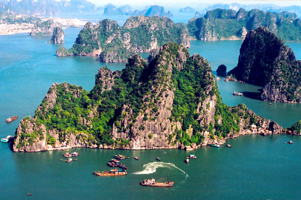
Situated in the north-east region of Viet Nam, Halong Bay is a part of Bac Bo Gulf and comprises the sea area of Halong City, Cam Pha Town and a part of Van Don island district, Quang Ninh Province. It borders Cat Ba Island to the south-west, the mainland to the west with a 120km-long coastline.
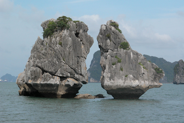
Halong Bay is a body of water of approximately 1,500 square kilometres in north Vietnam with a 120 kilometre coastline, in the Gulf of Tonkin Gulf of Tonkin near the border with China, and 170 kilometres east of Hanoi. Halong Bay - means "Bay of the Descending Dragon" in the Vietnamese language.

Halong Bay is a body of water of approximately 1,500 square kilometres in north Vietnam with a 120 kilometre coastline, in the Gulf of Tonkin Gulf of Tonkin near the border with China, and 170 kilometres east of Hanoi. Halong Bay - means "Bay of the Descending Dragon" in the Vietnamese language.

Halong Bay is a body of water of approximately 1,500 square kilometres in north Vietnam with a 120 kilometre coastline, in the Gulf of Tonkin Gulf of Tonkin near the border with China, and 170 kilometres east of Hanoi. Halong Bay - means "Bay of the Descending Dragon" in the Vietnamese language.

Halong Bay is a body of water of approximately 1,500 square kilometres in north Vietnam with a 120 kilometre coastline, in the Gulf of Tonkin Gulf of Tonkin near the border with China, and 170 kilometres east of Hanoi. Halong Bay - means "Bay of the Descending Dragon" in the Vietnamese language.

Halong Bay is a body of water of approximately 1,500 square kilometres in north Vietnam with a 120 kilometre coastline, in the Gulf of Tonkin Gulf of Tonkin near the border with China, and 170 kilometres east of Hanoi. Halong Bay - means "Bay of the Descending Dragon" in the Vietnamese language.

Halong Bay is a body of water of approximately 1,500 square kilometres in north Vietnam with a 120 kilometre coastline, in the Gulf of Tonkin Gulf of Tonkin near the border with China, and 170 kilometres east of Hanoi. Halong Bay - means "Bay of the Descending Dragon" in the Vietnamese language.

Halong Bay is a body of water of approximately 1,500 square kilometres in north Vietnam with a 120 kilometre coastline, in the Gulf of Tonkin Gulf of Tonkin near the border with China, and 170 kilometres east of Hanoi. Halong Bay - means "Bay of the Descending Dragon" in the Vietnamese language.

Halong Bay is a body of water of approximately 1,500 square kilometres in north Vietnam with a 120 kilometre coastline, in the Gulf of Tonkin Gulf of Tonkin near the border with China, and 170 kilometres east of Hanoi. Halong Bay - means "Bay of the Descending Dragon" in the Vietnamese language.
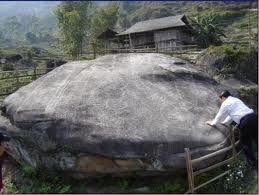
Arriving in Sapa, it is impossible not to mention the ancient rocks ground in Muong Hoa where is of great "god's books". The ancient rocks ground covers on an area of about 8 sq.km and a part of Lao Chai, Ta Van and Hau Thao communes, including 200 large and small stones spreading around Muong Hoa valley. It was discovered in 1925 by a Russian French orientalist Victor Goloubev. Also, scientists have found 159 large rocks with carving shapes, which are the most ancient stone steles in Vietnam.
Location and history
The old stone field of Nam Dan was found in 2004 by scientists from the Institute of Archeology and the Ha Giang Museum. This thousand year-old stone field inside the valley of Nam Dan has not been known widely by the visitors, but the beauty of the runic symbols on the rocks is very fascinating.
This stone field is located between Mount Tay Dan and Nam Dan hill, adjacent to Nam Khoong stream.
Attraction category
Check Available Online


